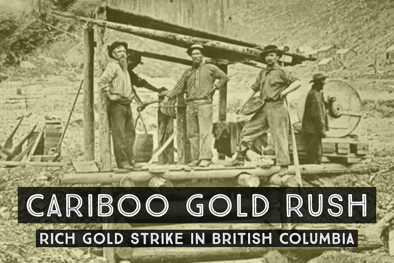
If the Fraser Gold Rush is something of the “founding gold rush” of British Columbia, Cariboo is one of the longest running and most famous. The Cariboo Gold Rush is so well-known that some even confuse the details of the Fraser with its events. This is because the discoveries in the Cariboo plateau, which is located on the interior region of British Columbia, began in 1858 as well.
It was in Hill’s Bar near the Fraser Canyon that the first strike was made. Today, the area is a ghost-town, but at the time it was the first active placer mining site when gold fever was in full swing.
Subsequent finds were made on the Horsefly River, which flows into Quesnel Lake. To the west of the lake, gold finds were made in the middle basin of the Quesnel River around Keithley Creek and Quesnel Forks. Mining in the nearby Antler Creek also proved to be lucrative, with prospectors able to find gold so close to the surface that they barely had to dig! This succession of gold discoveries prompted stronger interest from miners looking to get away from the crowds in Fraser.
Steady Growth of a Major Gold District
Unlike the Fraser Gold Rush whose developments happened almost overnight, the Cariboo Gold Rush took some time to mature. One of the reasons influencing this was the fact that the Cariboo area is significantly more mountainous than the Fraser area. It took some time for news to spread about these finds, and not all miners had the resources nor the inclination to brave the challenging and uncharted territory.
As a result, the gold rush did not begin in earnest until around 1861. While mineral interest was heightened during this period due to the gold rushes in the United States as well as in nearby Fraser, the American Civil War had broken out in 1861. This served as a trigger for many of the American miners in the north to head home and take sides. As such, while Fraser’s miners were largely American, the Cariboo Gold Rush saw more British and Canadian miners.
It was also around this time that the sandbars of the Fraser River had begun to be depleted, and the miners that had stuck around were ready to shift their focus. In spite of the challenging terrain and political climate, moving into the creek valleys in the northern Cariboo Plateau proved to be profitable.
Strike at Williams Creek
The discovery of Williams Creek was the spark that pushed the Cariboo area from a mere whisper of wealth to the full-fledged whirlwind of activity of a true mining hotspot. This Creek enters Willow River between Barkerville and the town of Wells, which is at the headwaters of Willow River. The Creek takes its name from a Prussian sailor named Wilhelm Dietz, who was credited with the first gold find in the area. His companions were also able to find gold in the surrounding bodies of water.
Upon hearing of the rich finds in the area, miners flocked to stake their claims. In the early years, the region between Willow River and Quesnel River was one of the most active and richest gold areas in all of Canada at the time. A man could wash gravels with their gold pan and recover gold from every scoop.
Records estimate that the value of the gold removed in 1863, a mere two years after the first find, was just under $4,000,000. Williams Creek and two of its tributaries, the Conklin and Stout’s Gulch, produced around $30,000,000 in gold from the year of the first find all the way up to 1898.
Williams Creek grew to produce the richest gold finds in the entire Cariboo area, and gave rise to the towns of Richfield, Barkerville and Camerontown. The latter two towns are named after two men in Dietz’s party, Billy Barker and John Cameron. These three towns served as supply, service and administrative towns to the flurry of activity in Williams, Keithley, Lightning, Lowhee and Grouse Creeks.
Today, Richfield and Camerontown are but a shadow of their former selves. It was Barkerville, which is served by the Cariboo Road, that proved to become the richest and outlast the days of its mineral boom.
The rich deposits in Barkerville were worked for quite some time from 1864 and well into the 1930s. Because of the high quality of gold in the area, the mining industry evolved significantly. From small teams of labor-intensive panning, the technology that the miners utilized grew into a more complex but efficient system that made use of hydraulic monitors. These directed jets of water toward the gold-bearing hillsides, washing the precious minerals into sluice boxes for further processing.

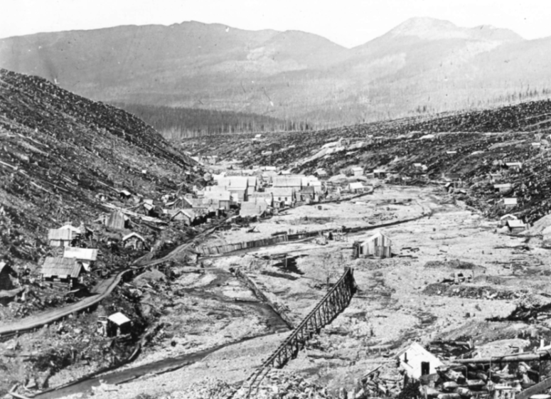
Williams Creek, Barkerville, British Columbia.
Punching Shafts & Rich Quartz Veins
When placer gold production began to peak, miners also began the search for lode gold deposits in Cariboo and were not disappointed. Some of the earliest and well-known claims in the area are Black Jack, Home Stake, Cornish and Wintrip claims. The Black Jack Vein in Westport takes its name from Black Jack and Burns Co., who sank a 180-foot shaft on their claim.
This proved to be highly profitable as the company was able to establish three levels with a few hundred feet of drifts and crosscuts. Reports from that time documented assays that were upwards of $70 per ton! This continued well into the 20th century, and the Williams Creek area grew to be the base for several profitable gold mines.
Lode deposits in this area are primarily gold-rich pyritic quartz veins with a few bedded replacements. These quartz-vein gold deposits are widely distributed all throughout the Cariboo region, with most of them small veins with large quantities of pyrite.

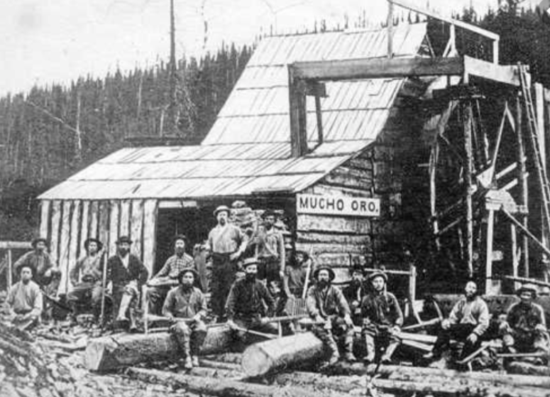
The Mucho Oro Mine. Barkerville, British Columbia.
An Established Mining Community
It was not only mining technology that experienced rapid progression due to the Cariboo Gold Rush – infrastructure boomed as well. As a result of the booming goldfields and the government’s desire to ensure control of their assets, the Cariboo Wagon Road was constructed in 1864. Prior to its construction, the older routes to get to the Interior had passed through Fraser Canyon and Douglas Road via Lillooet.
These roughly hewn cliffside trails were quite dangerous and not wide enough to accommodate efficient movement between towns. As a result, the colonial government began an undertaking involving the Royal Engineers, who were known as “sappers”, to develop the road.
The Cariboo Road bypassed the older routes and cut through the canyon of the Thompson River toward Ashcroft, moving through the valley of the Bonaparte River and finally reaching Lillooet at Clinton. The development of this path included remarkable engineering developments such as the construction of the original Alexandra Suspension Bridge of 1863. Though an expensive project, the Cariboo Road allowed for the transport of roughly 6.5 million dollars’ worth of gold and led to the development of Clinton and Barkerville.
Barkerville Remains
Despite the richness the placers and ores, excitement eventually wore off as the gold was depleted. The exceptionally rich placer deposits along Williams Creek produced for many years, but eventually dropped to a level that would not pay to work.
Later years saw the expansion of lode mines, which sustained Barkerville and the many miners that lived and worked there.
There are still active gold mines working in the same area of the Cariboo Gold Rush. Several large mining companies have several exploration projects in the works, and despite the long history of mining in the region there is still a considerable amount of gold still in the ground.
Barkerville is now a very popular tourist destination. The town has been very well preserved and encourages visitors to take a step back in time to see what life was like during the early days of the Gold Rush. You can take tours of the old buildings, pan for gold, learn about the early Chinese culture during the time, and countless more activities.
Additional Reading:
Barkerville Historic Town & Park
Mining History of Atlin, British Columbia
The Monsters of the Goldfields – Bucket Line Dredges
The Rocker Box – Mining Gear in the Early Goldfields
