
American poet and photographer Laura Gilpin once said, a river seems a magic thing. A magic, moving, living part of the very earth itself. Indeed, the many rivers across the world are mystical and complex, cutting paths across massive tracts of land and bearing bountiful fruits beneath their waters.
One such river is the Umpqua River, running 111 miles across the Beaver State. Its source begins in the southwestern side of Oregon in Roseburg, and flows northwest to empty into the Pacific at Winchester Bay. Douglas County houses the majority of the river’s watershed. You will find several campgrounds and RV parks along the coast, where camping and fishing adventures await.
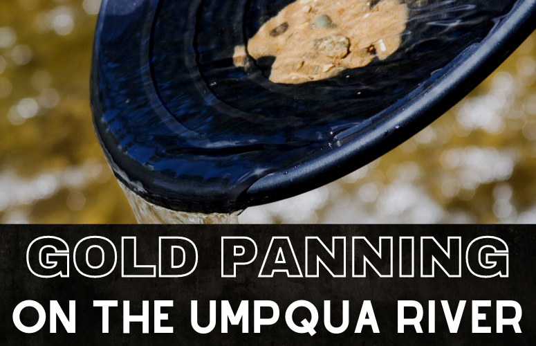
The Gold that Lies Beneath
Apart from fish, there’s another kind of treasure that rests beneath the waters. Black iron sands, a strong indicator of the presence of gold, abound along Umpqua. Indeed, hidden within those iron-rich sands are small particles of raw gold.
While the Cascade Mountains of Southern Oregon are mineral rich, with popular areas like the Rogue River and Applegate known for large nuggets, the Umpqua has gold of finer sizes. The Umpqua basin has a productive alluvial and hard rock mining history, known for fine gold in plentiful amounts.
One can typically expect a range from 100+ mesh size and under. However, despite the smaller sizes, Umpqua boasts a large amount of the mineral and collecting all that fine gold can add up. Since the early 1850s, miners on South Umpqua were noted to continually and consistently discover rich diggings, with some documented accounts between 1/4 ounce up to several ounces of gold per day. Early reports in the Oregonian noted a 6-ounce nugget find in Coffee Creek, the first mining camp on the South Fork of the Umpqua River, but by and large prospectors should expect majority of the gold on the South Fork to be of a finer quality.
Exploring the South Fork
The more popular area for prospectors is on the South Fork of Umpqua. This branch of the river follows alongside I-5 and runs through the well-established towns of Roseburg, Myrtle Creek and Canyonville. Because of the proximity to other areas in South Oregon whose gold industry boomed significantly, the South Fork of the Umpqua River has seen much activity. In addition, the easily accessible area has seen a great deal of prospecting in recent years, especially between Roseburg and Canyonville.
Public Gold Panning Sites on the Little Applegate River
Gold Panning at Brice & Sharps Creeks
Cow Creek Public Panning
Gold can be found in many areas beginning the I-5. One of the areas of note is Cow Creek, one of Umpqua’s tributaries also located near Roseburg. Cow Creek received a lot of attention during Southwest Oregon’s gold rush in the 1850s, predominantly via hydraulic mining, before the activity moved elsewhere.
Today, interested prospectors may visit the Cow Creek Recreation Area, where terrace gravels are fairly rich and can be quite productive. To get there, one can follow the road southwest from Riddle for 20 miles, with the Recreation Area having almost 1/4 mile of the creek open for public prospecting.
Myrtle Creek & other Tributaries
Northeast of Cow Creek lies another highly productive location called Myrtle Creek where the gold has been ground up through its passage through the waters. Gold flakes are plentiful on Myrtle Creek, which can be accessed from the I-5 as well. Hydraulic mining began here in 1909. One of its tributaries that are also known to yield gold is the Letitia Creek, with the nearby Chieftrain and Continental Mines that recovered over 100,000 ounces in its operating history.
Fine Gold & Good Access
Umpqua is an interesting destination for mining adventures due to the many campers and prospectors that pan the river year-round. It certainly makes for a much more enjoyable adventure to be able to help and be helped by the community in the area. Many old timers will tell you that the best time for mining gold along the Umpqua river would be in the summer. Once the waterline recedes, prospectors observe the bedrock for narrow, deep cracks running perpendicular to the river.
Gold on the bedrock are often in spots that have rust colored patches around them. From here it would be a simple matter to clean out the exposed gravels and begin panning. Though it takes time to sort though the black sand, the rewarding glint of gold will be winking at you soon enough. Some areas are also home to quartz, agate and jasper, so multiple colors in prospecting pans are not unheard of.
Bearing the quality of gold in mind, crevicing tools and screens are highly useful for prospectors in this area. Be careful and work slowly to capture all that tiny gold.
The Fabulously Rich Mines of Jacksonville